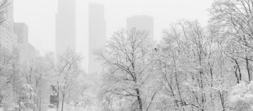
#Winter storm Stella will sweep into New York for the next day, delivering heavy snow and strong winds to the Northeast early, starting in the early morning. Forecasters are saying that blizzard conditions could possibly be developing in some regions, as roads may become impassable and strong winds could deliver power outages, falling trees and other storm damage.
Late on Monday, #New York City was preparing for the storm, with longer than usual waits at supermarkets, subway crowding and more traffic out of the city for those wanting to drive home.
People were stocking up on groceries and water, in case pipes burst or power was cut.
Four thousand flights have been cancelled. #Public schools in New York City have been temporarily shuttered and the MTA said that any aboveground trains would be closed from 4 am on Tuesday.
Further, higher and troublesome tides purportedly could cause coastal erosion on Tuesday, according to the Weather Channel, as up to two feet of #snow could fall in the city and the surrounding areas.
The areas affected
From Maine to Pennsylvania, #blizzard warnings have been called and the storm may even cause strong winds over Monday night as we head into early Tuesday morning, with a swath of snow to from the Midwest and along the north east.
What exactly is happening
Forecasters are blaming a #forceful area of low pressure developing off the East Coast around Monday evening that will intermix with some jet stream energy moving along the eastern states. This low pressure apparently could experience what is called #bombogenesis, as it shuttles northward near the coast on Tuesday night.The National Weather Service delivered the #blizzard notice to areas in eastern Pennsylvania, New Jersey and south eastern New York, as well as Connecticut, Rhode Island, Massachusetts and southeastern New Hampshire and parts of Maine.
How much snow will we see in the Northeast?
Experts are expecting up to one to two inches of #snow to fall per hour, which is not unusual during a blizzard.
Whilst heavy snowfall is predicted, the exact path and movement of the pressure low isn't a fait d'accompli. Therefore, there could be changes to the wintry forecast depending on the unknown evolution of isometric conditions. There could even be rain or sleet for a time out west of Interstate 95, but it is highly likely there will be snow.
Forecasters say it may not be out of the question that some places may gather up to #18-plus inches of snow from the frisky storm. Also, at the height of the storm snow could even fall at a rate of 1 to 4 inches per hour in the most extreme bands of the pressure system.
Blizzard and near-blizzard conditions, along with hefty wind gusts up to 50 mph, may trouble people on Monday night and through parts of Tuesday in the blizzard warning area. In other parts of the Northeast gusty winds will deliver blowing snow and low visibility, so it's not a good day to travel.
“It’s a good day to stay home,” Mr. Cuomo, the Governor of New York said.

