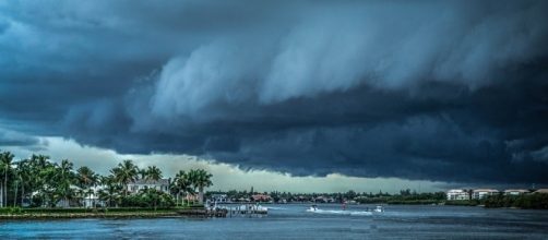
Hurricane Irma is showing startling similarities to Hurricane Harvey which recently deluged Houston and the Texas Gulf Coast. The storm, which was first named late last week, has built in the last 24 hours from a Category 3 hurricane to Category 5 status. In response to the storms rapid growth and projected models from various weather services, officials in the state of Florida have now issued a preemptive state of emergency and recommended Floridians prepare for the storm to hit the state.
Hurricane Irma builds quickly
On Tuesday morning, Hurricane Irma was moving across the Atlantic and barreling toward the Leeward Islands of the Eastern Caribbean at about 14 MPH.
The storm was a Category 4 system with sustained winds around 140 MPH. However, during the course of the day the storm continued to build strength and by 5pm EST on Tuesday Hurricane Irma became a record breaker.
At 5pm EST the storm was upgraded to a Category 5 storm and had sustained winds of 185 MPH. With winds at 185 MPH sustained, Hurricane Irma became the strongest storm on record in the Atlantic Ocean in terms of winds. On top of its powerful, sustained winds, Irma was packing a punch with gusts up to 225 MPH. The storm is projected to move over the northern Leeward Islands around Anguilla, St. Kitts and Nevis, St. Martin, and the British Virgin Islands.
Where Irma goes from here is still up in the air, but officials in the state of Florida aren't waiting to find out for sure.
With Hurricane Irma now a Category 5 storm, officials are warning people about the impending storm.
Irma's path tracking toward Florida
Hurricane Irma's path is projected to take it across the British Virgin Islands, US Virgin Islands, Puerto Rico, and Cuba before it swings northward. How the storm interacts with the mountainous terrain of Cuba could determine its inevitable path toward the United States. If the eye of the Category 5 storm passes directly over Cuba, it will bring incredible devastation, but the mountains of Cuba will also take a lot of punch out of the storm before it heads northwest.
If Hurricane Irma's eye skirts along the coast of Cuba, it is expected to maintain much of its strength as it heads toward the Florida peninsula.
In response to the growing concern over the storm, officials in Florida have issued mandatory evacuations in the Florida Keys with schools in the area closed indefinitely. Throughout southeastern Florida, residents are buying water, batteries, food, and plywood to try and prepare for the storm.
Third storm brews in the Atlantic
Irma hasn't even made landfall anywhere yet, and there's another storm building in the Atlantic Ocean that built enough strength in the past 24 hours to become a named storm on Tuesday afternoon. Tropical Storm Jose became the 10th named storm of the Atlantic hurricane season, but at the moment officials are hopeful it won't grow into a monster storm.
With Hurricane Irma still churning in the Atlantic Ocean, Jose doesn't have much energy to feed off of.
The wind sheers from the back end of Hurricane Irma are punching into Jose's leading edge and preventing it from building into a bigger storm for the moment. As of Tuesday evening, Tropical Storm Jose had sustained winds of 45 MPH. For a region battered by storms and hunkering down for another, fingers will be crossed throughout the Caribbean that Jose remains a low-level storm.


